
County: Statewide
Location: Atlantic County, Burlington County, and Camden County
Year Listed: 2026
Status: Endangered
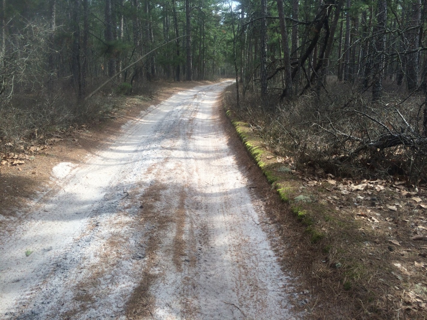
The evolution of New Jersey’s roads from native paths to superhighways reflect the state’s socioeconomic development throughout history. The changes and realignments of 250 years of modernization often erase what the past transportation landscape looked like. The historic roads of the New Jersey Pinelands, however, represent an extraordinary and largely intact example dating from the Colonial and Revolutionary War eras. Many of these routes, including Tuckerton Stage Road, Batsto-Fireline Road, Quaker Bridge Road, Hampton Road, and Pleasant Mills Road, originated between 1760 and 1850 and still trace their historic paths today. Unlike other parts of New Jersey, the Pinelands retains extensive sections of unpaved historic roads that preserve their original character, alignment, and landscape setting. Historical records, maps, and archival documents demonstrate that these routes were vital corridors for iron production, maritime commerce, privateering activities, salt works, and military operations during the Colonial and Revolutionary War periods. Prominent Revolutionary War figures including George Washington, Nathanael Greene, Count Pulaski, Benedict Arnold, and Charles Pettit documented the nature of travel and the activities they found along these same roads. Researchers also believe many routes originated as Native American trails that predate European settlement. Current studies utilizing mixed research methods including archival analysis, GIS mapping, LiDAR, GPS technology, and field documentation, are helping establish the roads’ historic provenance, physical integrity, and cultural significance, while also supporting future eligibility for State and National Register designation.
Despite their remarkable historic value, these roads face growing preservation threats due to neglect, lack of public awareness, inconsistent maintenance, and restrictions on continued use. Without active management and long-term preservation planning, portions of these historic corridors risk deterioration, overgrowth, and eventual disappearance, reclaimed and swallowed up by the surrounding forests. Researchers and preservation advocates emphasize that controlled recreational and public access can play a critical role in maintaining the physical condition and visibility of the routes while also enhancing public appreciation of New Jersey’s Revolutionary War history. The absence of interpretive signage, field guides, and educational materials has limited public understanding of the roads’ importance and diminished New Jersey’s visibility in the broader national narrative of Revolutionary War preservation.
Preservation organizations, recreation groups, and public access advocates continue to support efforts to document, preserve, and promote these corridors as living historic landscapes. Ongoing research at The City University of New York is further examining how active use versus abandonment affects the long-term preservation of historic roadbeds. Advocates hope that formal historic designation, combined with improved interpretation and preservation planning, will protect these roads for future generations while also supporting heritage tourism, recreation, and continued public engagement with New Jersey’s colonial and Revolutionary War past.